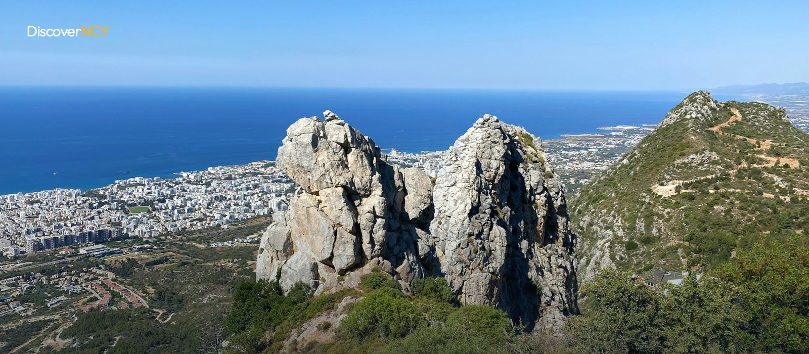
You arrive at the mountain road between the Acapulco junction in Kyrenia and Alevkaya and find that this road is closed to car and motorcycle traffic until precisely 30 September 2026... As someone planning to head out on the Kyrenia Mountains (Beşparmak) hiking trails, you might read the notice and assume going up is banned too, but bear in mind that the Highways Department announcement speaks only of through traffic and does not contain a single line about pedestrian access. Besides, there is another way to reach Alevkaya: the Değirmenlik-Catalkoy road has been open via service roads since June 2026, so the route is not cancelled; only the approach changes, from the Kyrenia side to the Catalkoy side. For most routes the starting point is central Kyrenia, 43-44 kilometres and roughly forty-five minutes from Ercan Airport.
The Kyrenia-Değirmenlik Road Is Closed Until 30 September
The decision came from the Highways Department, citing the safety of life and property. The work is being carried out under the TRNC Highway Master Plan, the closed section is the stretch between the Acapulco junction and Alevkaya, and the deadline has been extended once, from the original end date of 31 August to 30 September.
The hiker's question is of course narrower: which road do you take your car up? The road climbing from Catalkoy to Değirmenlik connects both to the Buffavento turn-off and to Alevkaya, so day trips are not affected by this closure. A driver who wants to climb from the Kyrenia side, on the other hand, has to continue east to the Catalkoy turn for the duration of the closure, because the open route up the mountain is the Değirmenlik-Catalkoy road. If the work finishes on time, the pass reopens. Our advice is to check the current situation before you set out.
Where Do the Trail's 18 Stages Run?
The route running along the ridge appears in English sources as the "Kyrenia Mountain Trail"; its local name is the "Beşparmak Trail". The trail starts in the west at Cape Kormakitis (Koruçam Burnu), ends in the east at Cape Apostolos Andreas (Zafer Burnu) at the tip of the Karpaz Peninsula, and the official tourism material divides it into 18 stages. The terrain does not stay the same over this length. Some sections are steep and rugged, some hilly, and some drop down to a shallow coastal strip. In the sources we reviewed the trail's total length does not add up consistently, so the number of stages is a more reliable measure than the kilometres...
The difficulty is described as moderate. It needs no technical climbing, but sure footing is essential on the rocky sections. Waymarking uses a letter "B" on a green and white background, though there is a warning that trail markings in the country are inconsistent and some sections exist only on the map. Two figures in the sources will mislead you here. The highest recorded point on the trail is 843 metres, whereas the range's summit is Selvili Tepe at 1,024 metres, so do not think of Selvili Tepe as a stop waiting for you on the trail, because there is a gap of roughly one hundred and eighty metres between the two figures. On the other hand, anyone intending a multi-stage hike has to arrange accommodation and transport in advance, because there is almost no regular timetabled service along the trail.
The Twenty Minutes Up to Buffavento
A narrow mountain road branching off the Kyrenia-Catalkoy-Değirmenlik road reaches the Buffavento car park after six and a half kilometres, and from there the path and steps up to the castle take twenty to thirty minutes. There is no ticket booth; entry is free. It is one of the three Byzantine castles strung along the ridge, and all three sit within sight of one another. The castle sits at roughly 950 metres, and at the top you can appreciate how much height a short path gains. Among the day trips, this is the most rewarding...
Most Routes Start from Alevkaya
The Alevkaya Forest Station lies on the Nicosia-facing slope of the Kyrenia Mountains, near Değirmenlik, and administratively falls within Kyrenia. Most of the day routes set off from here and the stages of the long trail also pass nearby, so on the Kyrenia Mountains hiking trails the short routes and the long stages intersect at this point. In the display cases of the station's Herbarium you can see more than one thousand two hundred plant specimens collected by the botanist Deryck Viney. Will someone setting off in the afternoon make it here in time? The doors open at eight in the morning and close at four, so a late start misses this stop. The ruins of the Armenian monastery of Sourp Magar are a twenty-minute descent from the station, and you will find an area laid out for picnics around it. That said, the return must be reckoned alongside the descent. The same slope has to be climbed back up.
A Sample Day from Doğanköy to Ozanköy
One of the documented routes traces a loop that sets off from the Karakum district of Kyrenia and returns to the same spot. The route first calls at Doğanköy, passes the Bozdağ forest and the Süleyman Paşa mansion, descends to Bellapais Abbey in Bellapais (Beylerbeyi), then climbs the ridges above Beylerbeyi. The lunch break is taken on Güvenç Tepe. The return is completed via Ozanköy (Kazafani) and the coast; the recorded distance is 23 kilometres and the time runs from nine in the morning to half past five, about eight and a half hours. The ground changes constantly too, with the route shifting between forest path, dirt track and village street. Reading through the trip diaries, we found the hiker noting myrtle berries and cyclamen in the forest section. The record dates from the winter of 2016. This route is an example, not a timetable...
Karmi and the Hilarion Road at the Western End
It lies about eight kilometres from central Kyrenia. At the foot of the Kyrenia Mountains sits the village of Karmi (Karaman), known by its old name of Karmi, and since it was built at an altitude of roughly 350 metres, it makes a good reference point when starting a day that heads up the mountain... On the eastern side of the same slope, at 732 metres, stands St. Hilarion Castle, and from its western face you can take in the panorama of the ridge. However, part of the connecting road to the castle passes through a military zone. Stopping and taking photographs there is prohibited. This restriction applies to that road alone; no such rule is reported for the range as a whole.
The Best Window Opens in Spring
You have seen the western end, and now it is time for the calendar. We read plenty of comments online, but in our view the best period for hiking the Kyrenia Mountains is spring and early summer. The orchids and endemic flowers bloom in those months, whereas you should not put a long stage at midday in summer on your programme; the sources do not recommend it. The same calendar determines something else too: the island's only dangerous snake, the Cyprus blunt-nosed viper (Macrovipera lebetina lebetina), is active between March and November. The figures do not warrant panic. On average twenty bites are recorded nationwide per year, and no fatal case has been seen in the past fifteen years.
In addition, as we said earlier, wear sturdy walking shoes and carry more water in your pack than you calculated. After rain the rocky and stepped sections become slippery, and that is exactly where you will see a solid sole earn its keep. Connectivity and such things can cause a few headaches: since mobile coverage can weaken in some sections, carry a printed map or an offline route. What about those who do not want to work all this out alone? The Mountaineering Sports Association, founded in 1995, publishes a programme every month, and the number of routes it has set out across the country approaches forty.
If you have read this far, you will have seen that a twenty-minute castle path and an eight-and-a-half-hour day hike stand side by side on the same ridge, and the choice between those two extremes comes down to the hours you can spare and the state of the road on the day.
| Field | Value |
|---|---|
| Mountain range | Kyrenia Mountains (Beşparmak, Pentadaktylos in Greek) |
| Extent | From Cape Kormakitis (Koruçam) to Cape Apostolos Andreas (Zafer Burnu), about 160-170 km |
| Width | 8-10 km |
| Highest point | Selvili Tepe, 1,024 m, Kyrenia district |
| Long-distance trail | Beşparmak Trail / Kyrenia Mountain Trail, the TRNC's official walking route |
| Number of stages | 18 (official tourism source); total length varies by source between 255 and 290 km |
| Trail's highest recorded point | 843 m |
| Waymarking | Letter "B" on a green-and-white background; marker maintenance is patchy in places |
| Difficulty | Moderate; sure footing needed on rocky sections |
| Buffavento ascent | 6.5 km from the Değirmenlik road + 20-30 min on the path from the car park, free |
| Alevkaya Forest Station | Trailhead; Herbarium 08.00-16.00, 20 min to Sourp Magar |
| Sample day route | Doğanköy-Bellapais (Beylerbeyi)-Ozanköy, 23 km, about 8.5 hours (2016 record) |
| Karmi (Karaman) | ~8 km from Kyrenia, about 350 m elevation |
| Hiking club | Mountaineering Sports Association (1995), ~40 routes across the TRNC, monthly programme |
| Best season | Spring and early summer; long stages not advised at midday in summer |
| Road conditions | Acapulco Junction-Alevkaya mountain road closed to cars and motorcycles until 30 September 2026 |
| Snakes | Macrovipera lebetina lebetina, active March-November, ~20 cases a year, no deaths in 15 years |
| Getting to Kyrenia | 43-44 km from Ercan Airport, about 45 min |
We describe the station where the routes begin in detail in our Alevkaya herbarium article and the castle on the ridge on our Buffavento Castle page; for the village at the western end, see our Karmi village Kyrenia guide.