Yeşilırmak (Limnitis): Border Village and Strawberry Guide
📍 Yeşilırmak, Lefka
Did you know that getting from Kato Pyrgos to Nicosia once took three hours? The same journey can now be done in an hour and a half. What halved the time? It is said to be the Yeşilırmak border crossing, opened on 14 October 2010, and the village at the island's westernmost tip thus entered the travel itineraries. Yeşilırmak is a strawberry village in the western corner of Cyprus, attached to Lefka (Lefke), where according to the 2011 census 458 people lived in 146 households. Its old name is Limnitis, and its native population consists entirely of Turkish Cypriots. A day set aside for here is mostly divided between the crossing rules, the harvest calendar and the small cove on the coast. But the crossing does not open to everyone in the same way.
The Crossing Is Open Only to Vehicles
Yeşilırmak is the seventh crossing point opened in Cyprus. It was announced on 26 June 2009 that the crossing would be built, and the foundation of the roughly six-kilometre link road between Yeşilırmak and Pyrgos was laid on 29 March of the following year. The opening ceremony took place on 14 October of the same year, and at the ceremony the TRNC President of the time, Derviş Eroğlu, stood side by side with the Greek Cypriot leader Dimitris Christofias. EU Enlargement Commissioner Štefan Füle and the United Nations Special Representative for Cyprus Alexander Downer were also there, which means a six-kilometre link road was not being treated as a small village matter.
As we have described before, that is the historical side. In practice the most confused point is the type of crossing: you can only cross here by vehicle, and there is no pedestrian crossing. Because the gate is open only to vehicle traffic, a traveller without a car needs to plan the route around a different crossing from the start. An ID card or passport is requested at the crossing. Crossing to the South with a Turkish Republic ID card is not possible in any way; for that a passport and a visa obtained from the embassy in Athens are required. Since no specific working hours are announced for the crossing, it is worth confirming the current hours before setting out.
The Strawberry Calendar Splits into Two Seasons
For a visitor who is not going to cross, the village's real business turns in the fields. But which month should you come? We can't actually give you a single month, because it doesn't come down to one. The harvest here is split into two separate seasons. Open-field strawberries begin to be picked in February and March, while in the greenhouses the calendar is set the other way round: seedlings planted in September and October bear fruit two months later, between November and December. Because the early crop fetches a higher price, the greenhouse side has deliberately brought this work forward. According to a 2015 news report the method works like this: seedlings are grown on coconut husk, irrigation is computer-controlled, no hormones are used, and the Department of Agriculture takes regular samples. The number of producers and the size of the greenhouses may of course have changed in the years since, but the splitting of the season in two still stands as the main line that defines the village's economy. The gardens don't work only for strawberries either; the same soil yields taro (kolokas), olives, carob, bananas, citrus, figs, loquats, plums, peaches and grapes.
The Strawberry Festival Keeps the Village Busy for Two Days
Field calendar aside, the days when the village gets crowded come in May. In 2026 the 15th Traditional Yeşilırmak Strawberry Festival was held on 9 and 10 May at the village Festival Ground. The programme started on the first day at 10.45 with a parade, the opening was at 11.00, and then over two days concerts, a nature walk, competitions, folk dance shows and handicraft and food stalls followed one another. Picking strawberries from the field is also part of the programme, so anyone who times a visit to the festival sees the crop right in the field. The organisation is run by the Yeşilırmak-Yedidalga Producers' Union, with contributions from Lefka Municipality and the European University of Lefke. A programme spread over two days forces a small calculation: either the same road is driven twice, or the night is spent on the Lefka side, because there is no accommodation in the village.
The Village Itself and the Small Cove on the Coast
On days outside the festival the scale is much smaller. Yeşilırmak is one of the westernmost settlements on the map of Cyprus and is counted in the Tylliria (Dillirga) region. In the 1960 census there were 323 people, in 1973 about 396 lived here, and in the official 2011 census 458 people were registered in 146 households. The sources report that around 2,000 people of village origin live in the United Kingdom and 1,500 in Australia, which means the population abroad is several times the one that stayed in the village. At first glance these figures make it look as if the village is emptying out, but the fields still keep their own calendar. Administrative affiliation gets confused from time to time: Lefka Municipality counts the village in its own list of settlements, while some tourism sites loosely file the area under the Morphou (Guzelyurt) side.
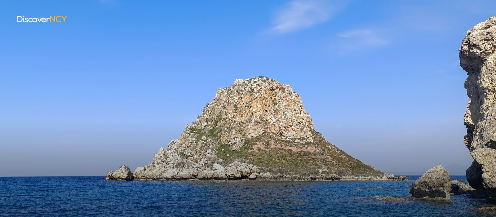
Inside the village stands a rock formation surrounded by vineyards and orchards, called Yeşilırmak Rock, with paths around it. There is also a very old vine, noted for a trunk 85 centimetres thick, said to yield about three tons of grapes a year. Down at the coast the scale shrinks altogether: the beach lies in a small, secluded cove at the island's westernmost tip.
The Route towards Vouni Doesn't End on the Asphalt
The second route out of the village is the walking trail that stretches to Vouni Palace. Lefka Municipality calls this line one of the most scenic routes in the country, but gives no official distance or duration. The only detailed measurement sits in a 2015 hiking record. According to that record, the line starting from Asmalı beach reaches Lefka via Yeşilırmak, Bademliköy, Vouni Palace, Çukur Galif, Yedidalga, the Soli Basilica and Gemikonağı (Karavostasi), totals 24 kilometres, and the walk that started at 08.30 ended at 16.30. The same record describes the stretch between Yeşilırmak and Vouni as dirt road and footpath, and marks the difficulty as moderate to hard. Does an eight-hour walk fit into a day-trip programme? It doesn't, because that time eats the whole day, while the same three stops can be toured far more quickly by car. Soli and Vouni are paid visitor sites, and both line up along the same coastal strip. The road within the village and the link up to Lefka are asphalt, and this should not be confused with the trail.
Lefka 18 Kilometres, Nicosia 75
As we mentioned, once you say touring by car, the distance sums come into play. Between Yeşilırmak and Lefka it is 18 kilometres and takes 34 minutes in normal conditions, while the figure given for Nicosia is about 75 kilometres and 1 hour 24 minutes. There is no directly measured figure for Morphou and Kyrenia; adding up via Lefka puts Morphou at 36 and Kyrenia at between 85 and 90 kilometres, so these two numbers are rough estimates. Because Yeşilırmak sits at the western tip of Cyprus, basing the programme in Lefka is the most sensible way, since a 34-minute drive comfortably allows leaving in the morning and returning in the evening. No separate preparation is needed on the road side: the village road is asphalt and maintained by the municipality, and Lefka Municipality has included the Yeşilırmak Mosque road in its recent asphalting programme. For a plan that leaves in the morning and returns in the evening, only two figures are needed: 18 kilometres and 34 minutes.
| Field | Value |
|---|---|
| Place name | Yeşilırmak (formerly Limnitis / Limnidi) |
| District | Lefka (Lefke); loosely grouped under the Morphou (Guzelyurt) area in some tourism sources |
| Location | Westernmost tip of the island, Dillirga (Tylliria) region |
| Population | 458 people, 146 households in the 2011 census (323 in 1960, ~396 in 1973) |
| Crossing point opened | 14 October 2010, at a ceremony with Derviş Eroğlu and Dimitris Christofias |
| Crossing order | Seventh crossing point on the island |
| Crossing type | Vehicles only, no pedestrian crossing |
| Impact of the crossing | Kato Pyrgos to Nicosia cut from 3 hours to 1.5 hours |
| Document rule | No crossing to the South with a Turkish ID card; passport and Athens visa required |
| Main crop | Strawberries, alongside kolokasi (taro), olives, carob, bananas, citrus, figs, grapes |
| Harvest calendar | Greenhouse November-December, open field February-March |
| Strawberry Festival 2026 | 15th Traditional, 9-10 May, Yeşilırmak Festival Grounds |
| Beach | Small, secluded cove at the westernmost point of the island |
| Hiking trail | Dirt road and footpath towards Vouni Palace, 24 km / ~8 hours in a 2015 record |
| Yeşilırmak - Lefka | 18 km / 34 minutes |
| Yeşilırmak - Nicosia | ~75 km / ~1 hour 24 minutes |
| Accommodation | No facilities in the village; day trip based in Lefka or Morphou |
For the two paid sites on the same coastal strip see our Vouni Palace and Soli ruins pages; for the wider western region there is the Guzelyurt and Lefke guide.