Geçitköy Dam: Nature Walk and Picnic
📍 Geçitköy, Kyrenia
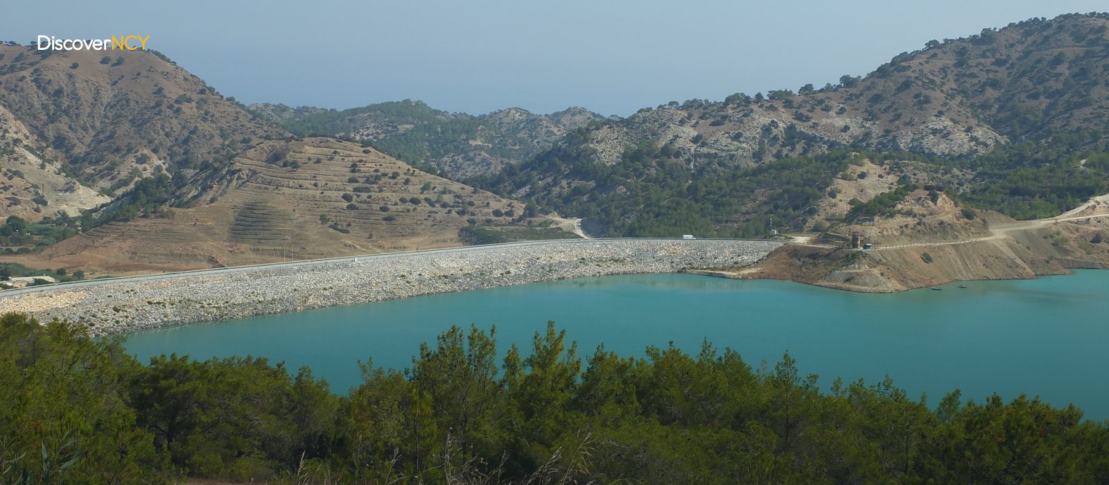
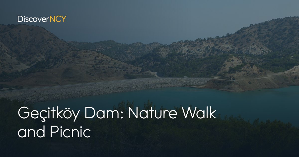
Anyone who turns off the road between Kyrenia and Morphou (Güzelyurt) and walks down to the lakeshore would think they were at a picnic spot. Yet Geçitköy Dam was not built to be visited. Its body is rockfill, and its job is to carry drinking water to the network and irrigation water to the surrounding fields. Part of the water filling the lake comes from under the sea, from the Anamur district of Mersin. Those walking along the shore, meanwhile, have made the news. In the records we examined, the facility's technical specifications were written down to the cubic metre, yet we did not come across any announced rule on swimming, picnicking, fishing or climbing onto the dam body, so let's take a detailed look…
A Lake Whose Water Comes from Anamur
The line feeding the lake starts in Mersin. It is built on the “Dragon Stream” in Anamur. Water taken from the “Alaköprü Dam” reaches the island through a pipeline laid beneath the Mediterranean, and after coming ashore it passes through the “Güzelyalı” pumping station, from where it is transferred to the lake via a connection of about three kilometres. The dam body was completed on 7 March 2014, while water from Turkey first entered here about a year and a half later, on 17 October 2015, and the transfer has continued ever since. English Wikipedia shows the dam body on the Mandara (Mandra) River, meaning that the lake whose water comes from under the sea was built on one of the island's own streams. In the lake, the water is split in two.
According to the breakdown given by Turkish Wikipedia, 1.20 cubic metres per second is distributed directly to the drinking water lines and 1.18 cubic metres is stored in the lake for irrigation. The total is 2.38 cubic metres per second. Why is not all the incoming water fed into the network? Because according to the same source, the share allocated to irrigation is about half of the project's total water and is stored in the lake, and Wikipedia and haber7 give the irrigated area as about 4,824 hectares, meaning the real recipients of this water are not the visitors walking along the shore but the farmers working those fields. According to project data, the target is to carry 75 million cubic metres of water a year to North Cyprus, while the roughly 35 million cubic metres given by Wikipedia is a measure of the lake's own volume, not of this annual target. Our advice to you is to keep this chain in mind, because it shows why the facility is referred to as water infrastructure...
Where Did the 1989 Dam Go?
The lake is not actually a dug-out pit. According to the English Wikipedia article we have, a small dam of about 1.8 million cubic metres built in 1989 stood in the same place, and its name was the “Dağdere Dam”. Works that began on 30 March 2012 and were completed on 7 March 2014 enlarged that reservoir, and the volume increased about twentyfold. The reservoir is now a lake. According to Wikipedia, today's dam body is a clay-core rockfill mass 65 metres high, and the transformation of that small reservoir into a lake rests on this height. There is a single source. We give the enlargement figure on its basis.
A Water Facility for Which We Could Not Find Any Rule Record
The main question for anyone going down to the lakeshore is whether swimming, picnicking and fishing are possible, yet since the dam is an infrastructure facility operating as part of the drinking water network, the priority lies not with the visitor but with the water itself. We could not find a rule record specific to Geçitköy for swimming, fishing, picnicking, climbing onto the dam body or drones. In the same records we found neither a prohibition nor a permission provision. Besides, it would also be wrong to carry over here the entry and drone bans published for dams in Turkey, because those regulations fall within the scope of another administration.
Without such a record, what can you go by? There seems to be no solid way other than asking the competent authority, because the only binding text is either the sign on site or the department's answer. Let us also note that news reports saying locals have made this a resting place for the view do not count as a permit...
The Picnic Area Appears in the Source as a Project
The walking and picnic facilities mentioned in the title appear as a project in the source we have. The plan, referred to as the “Geçitköy Dam Picnic Area”, will include walking paths, running and cycling tracks, children's playgrounds, an adventure park, country restaurants, picnic areas and wildlife observation towers around the lake, with its energy to be supplied from renewable sources. On the other hand, the source we reviewed writes all of these in the future tense. What we have is a planned investment, and neither a timetable nor a responsible institution accompanies the plan. We could not verify whether there are marked trails, benches or rubbish bins on the lakeshore, so do not go expecting them to be ready.
Those Who Climb Down the Slope When the Water Recedes
In periods when the water decreases, the lakeshore retreats downwards and the slope in between gets longer. “Kıbrıs Gazetesi” reported that on days when the level dropped by about ninety percent after a failure in the pipeline, some people climbed down a stony slope of about a hundred metres to cast their lines, and the report describes this as a dance with death. The ground consists of loose stone... Climbing down a rockfill slope is dangerous. The risk of falling is real. According to information in the same report, the “State Water Works Department (Devlet Su İşleri Dairesi)” stopped farmers from drawing water with motor pumps in order to protect the creatures remaining in the lake. But the question is this: why does the shoreline shift so much? The report attributes the drop in level to the failure in the pipeline, and since the lake is fed both by the stream it is built on and by the undersea line, an interruption in the line is also reflected in the lake's level. For this reason, the full lake in a photo and the shore you will see may not be the same.
Whom to Ask Before Setting Off
The facility is located on the main road between Kyrenia and Morphou (Güzelyurt), near Geçitköy. In this area, the name Geçitköy is also given to the pass where the Lapta Mountains rise steeply from the coast. In visitor reviews you may see mentions of a long and rough walk around the lake, but the description there is more an impression than a route. As of October 2026, our recommendation to anyone going to Geçitköy Dam is to ask the “Water Works Department (Su İşleri Dairesi)” what can be done before setting off, and to check the signs on site. You can also ask the same office about parking and the entry point. Do not go down without having the answer, because this is an operating water infrastructure facility.
| Field | Value | Source |
|---|---|---|
| Type and dam height | Clay-core rockfill, 65 metres | Turkish and English Wikipedia |
| Storage capacity | About 35 million cubic metres | Turkish and English Wikipedia |
| Irrigation area | About 4,824 hectares | Turkish Wikipedia, haber7 |
| Function | Drinking water and irrigation | Turkish and English Wikipedia |
| Associated project | TRNC Water Supply Project | Turkish Wikipedia, kibristatatile |
| Picnic area | Project of about 220 hectares, implementation unconfirmed | kibristatatile |
| Entry, fee, swimming, picnicking, drones | We could not find a publicly available rule record, confirmation needed | Sign on site, Water Works Department |
We have gathered the mountain trails around the dam in our Kyrenia Mountains hiking trails guide; for the west coast and its districts, see our Morphou and Lefke travel guide and Alsancak and Lapta travel guide.